
A Life Without Limits
  • Surveying
    • Surveying Roles
    • Specialisations and Related Fields
      • Specialisations
      • Civil Engineering
      • Geospatial Science
      • Hydrography
    • The History of Surveying
    • Technology
      • Surveying Technology
      • 3D Scanning
      • GPS
      • Drones
      • Pokémon and Surveying
      • GDA2020 – Modernising Australia’s Datum
    • Cool Projects
    • Defining Surveying
  • Profiles
    • Meet a Current Surveying Student
    • Meet a Survey Assistant
    • Meet a University Student Project of the Year Winner
    • Meet a Graduate Surveyor
    • Meet a 3D Modeller and Surveyor
    • Meet a Trainee Licensed Surveyor
    • Meet a Newly Licensed Surveyor
    • Meet a Senior Licensed Surveyor
    • Young Surveying Professional of the Year
    • Professional Surveyor of the Year
    • Meet a Senior Lecturer in Surveying
    • Meet a Surveyor General
    • Women in Surveying
  • Study Pathways
    • Victorian Study Pathways
    • Where To Study
    • Distance Education
  • Career Resources
    • Get Kids into Survey
    • Career Resources
  • Experience Surveying
    • Try Surveying in Victoria
    • Try Surveying in NSW
  • Industry Partners
  • Connect with Industry
    • Find a Job
    • Work Experience
  • More Info
    • Blog
    • Is Surveying for Me?
    • Surveying and STEM careers
    • Demand for Surveyors
    • In the News
    • Videos
      • Videos About Surveying
      • Surveying With Evan Webster
      • Women in Surveying Day
      • Student Experience Days
    • FAQs
    • Contact Us

Blog

What does a surveyor do?

August 15, 2022Kim Hesse

Have you ever heard the term ‘Licensed’ or ‘Registered land surveyor’ and ever wondered what they actually do?

Chances are, there’s a lot more to land surveying than you originally thought.

In short, a land surveyor measures and maps out the surrounding environment using mathematics, specialised technology and equipment.

Within their role, a land surveyor can measure just about anything on land, in the sky or on the ocean bed. They even measure polar ice-caps. Surveyors have the best of both worlds being able to work in the office and out in the field, from suits to boots!

Out in the field

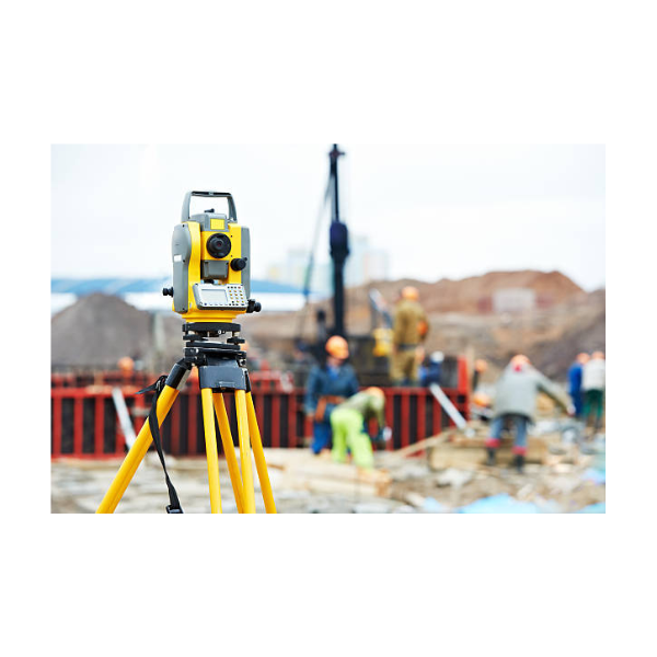
Surveyors use latest technology such as high order GPS, Robotic Total Stations (theodolites), and aerial and terrestrial scanners to map an area, making computations and taking photos as evidence.

In the office

Surveyors then use sophisticated software, such as auto-cad to draft plans and map the onsite measurements. Surveyors work on a diverse variety of projects from land subdivision and mining exploration, to tunnel building and major construction, which means no two days are the same. They are experts in determining land size and measurement. They also give advice and provide information to guide the work of engineers, architects and developers.

Does this sound like you?

Would you like to know more about the road to becoming a licensed or registered surveyor? click here

Previous post Why do I need a licensed or registered surveyor? Next post Where can I study Surveying?

Contact Us

Surveying Task Force Victoria
info@alifewithoutlimits.com.au

News

  • What Does Surveying Have to Do with the NFL? More Than You Might Think!
  • Your Fence Might Not Be Your Boundary: The Surveying Behind Property Lines
  • From Menindee to the Murray: How Surveying Helps Manage Our Water
  • Your Phone Has GPS. So Why Do We Still Need Surveyors?

Pathways

  • Study Pathways – VIC

Follow us

© Copyright 2020. A Life Without Limits | Surveying Task Force Inc.