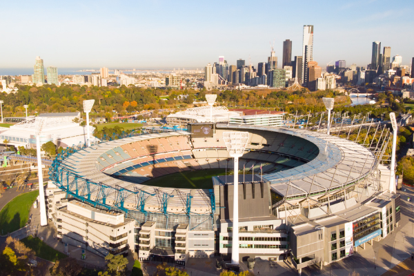
A Life Without Limits
  • Surveying
    • Surveying Roles
    • Specialisations and Related Fields
      • Specialisations
      • Civil Engineering
      • Geospatial Science
      • Hydrography
    • Technology
      • Surveying Technology
      • 3D Scanning
      • Pokémon and Surveying
      • GDA2020 – Modernising Australia’s Datum
    • Cool Projects
  • Profiles
    • Meet a Current Surveying Student
    • Meet a Survey Assistant
    • Meet a University Student Project of the Year Winner
    • Meet a Graduate Surveyor
    • Meet a 3D Modeller and Surveyor
    • Meet a Trainee Licensed Surveyor
    • Meet a Newly Licensed Surveyor
    • Meet a Senior Licensed Surveyor
    • Meet a Surveyor General
    • Young Surveying Professional of the Year 2019
    • Women in Surveying
  • Study
    • NSW & ACT >
      • Study Pathways
      • Where To Study
      • NSW Scholarships
    • QLD >
      • Study Pathways
      • Where To Study
      • Qld Scholarships
    • SA >
      • Study Pathways and Institutions
    • VIC >
      • Study Pathways
      • Where To Study
    • WA >
      • Study Pathways
      • Where To Study
    • Distance >
      • Distance Education
  • Career Resources
    • Career Resources
  • Experience Surveying
    • Work Experience
    • Try Surveying in Victoria
    • Try Surveying in NSW
  • Jobs
    • Job Opportunities
    • Demand for Surveyors
  • More info
    • Blog
    • Ask a Surveyor
    • Is Surveying for Me?
    • In the News
    • Videos About Surveying
    • FAQs
    • Contact Us

Surveying Roles

Surveyors can take on many different tasks and roles during their careers, depending on their qualifications and level of experience.

Surveying students at TAFE and university are able to get a taste of what surveying is really like by starting out as a survey assistant during their study. TAFE students can then move into a surveying technician or draftsperson role once they are qualified. Meanwhile, those in university complete their degree as a graduate surveyor, with some choosing to specialise in other related fields like geospatial information systems.

Graduate surveyors can further their career opportunities and remuneration by undertaking a professional training agreement to become a licensed surveyor.

Licensed / Registered Surveyor

Typical salary: Starts from $90,000 + vehicle

Study: Undergraduate degree + postgraduate degree + professional training agreement

A licensed or registered surveyor is the only person who is legally authorised to perform land or cadastral surveying and sign-off on projects.

They perform the following tasks:

  • Apply the laws & procedures relating to land ownership, boundaries and titles when undertaking surveying work
  • Accurately map out positions of boundaries where land is subdivided, bought or sold
  • Study the natural and urban environment
  • Plan and provide critical advice for project developments in land and buildings
  • Manage projects from planning approval through construction for land development in urban, rural and regional areas
  • Utilise cutting-edge technology such as GPS and laser technology to measure angles and distances on the land

Read about Tom’s journey to become a newly licensed surveyor, and Joe’s unique experience surveying the outback.

Surveyor / Graduate Surveyor

Typical salary: Start from $55,000 (plus use of a vehicle within six months)

Study: Undergraduate or postgraduate degree

Surveyors perform the following tasks:

  • Measure the size and shape of an area of land
  • Work out the position of boundaries of public or private land
  • Study the natural and natural environment
  • Physically set out land and building developments

Surveyors work in many related fields such as cartography, geographic information systems (GIS), remote sensing surveying or as project managers. Find out why Elaine decided to become a surveyor.

Surveying Technician / Draftsperson

Typical salary: $64,000 with five years experience (technician may also have use of vehicle)

Study: TAFE or VET diploma

Surveying technicians collect, analyse data and develop plans for land Surveyors to provide the basic information required for a surveying project.

They may do the following:

  • Take measurements and collect information using high tech equipment
  • Analyse survey data and make calculations
  • Draft plans and plot data using computer software
  • Set out reference points on mining and construction activities

Surveying technicians are involved in various projects such as survey drafting, photogrammetry, mining, land development, engineering and construction surveying.

Survey Assistant

Typical salary: $42,000

Study: TAFE or VET Certificate III (traineeship)

Survey assistants help surveyors undertake surveying projects.

They may do the following tasks:

  • Maintain and use surveying equipment
  • Assist surveyors in taking measurements
  • Record measurements manually or electronically
  • Peg out boundaries

Find out more about Lucas’ journey to become a survey assistant in this video.

Other related fields

Spatial Coordinator

Spatial information professionals specialise in the collection and analysis of location specific data about populations, land use and more.

Spatial Coodinator

They perform the following tasks:

  • Produce paper and electronic maps using a variety of software
  • Take part in design and management of geographical information systems (GIS)
  • Design interactive mapping products for computer systems and the web
  • Work with cartographic technicians and other production team members

GIS Analyst

GIS analysts analyse and provide technical support to help environmental management, exploration & mining, land ownership titles and urban & regional planning.

They perform the following tasks:

  • Undertake complex computer functions such as 3D modeling to create visual representations of data
  • Use GIS software and processes to performing spatial analysis in order to produce data layers, map tables and reports
  • Prepare technical documents, reports and summaries using GIS applications
  • Carry out quality control on final data

GIS Officer, Graduate (GIS) and GIS Assistant

GIS professionals develop and customise geographic information systems (GIS).

They can do the following:

  • Map physical and manmade features
  • Take measurements and make observations from aerial photographs
  • Create complex models to assist council, government and land professionals
  • Study the natural and urban environment
  • Store data in geographic information systems (GIS)

Watch this video to find out more about studying geospatial science or visit www.geospatialscience.com.au.

Read more about surveying on our blog here…

Surveying with the Stars

October 24, 2019Michelle Brooks

The silver screen is filled with heroic figures that hail from enviable professions. Army generals. Astronauts. Cops. Presidents. Surveyors. …Surveyors? That’s right. You might have missed the memo, but Hollywood has a long and illustrious career of sneaking surveying into the background – and sometimes foreground – of their blockbusters. In fact, some of the biggest stars…

Read More

Repositioning Australia

October 10, 2019Michelle Brooks

It’s one of the biggest seismic shifts in the geodesy landscape, and the groundwork is being laid for it right now. We’re referring, of course, to the 2020 update of the Australian Geospatial Reference System. Don’t have the foggiest as to what we’re talking about? For surveyors and other spatial specialists, the Australian Geospatial Reference…

Read More

Tracking famous surveyors through history

August 22, 2019Michelle Brooks

Surveying is not just an old profession; it is also a highly-respected profession. With surveyors being so instrumental in the measurement and recording of the very ground that we walk upon, there have been many across the centuries that have aspired to join the surveying ranks – particularly during eras of great exploration. It comes…

Read More

That equipment belongs in a museum

July 29, 2019Michelle Brooks

There is no doubt that the history of surveying in this sunburnt country is a fascinating one. You may have already read one of our previous blog articles looking into Australian surveying history. Reading about it is one thing, however – seeing it is another! Retracing the footsteps of the surveyors that mapped Australia is…

Read More

Five reasons you need a land surveyor

July 3, 2019Michelle Brooks

Surveying is an important but little understood part of the building process. The surveyor is the link between design and construction. You may need a land surveyor for many reasons. Here are just a few: 1. You want to extend your home When planning an extension, a surveyor needs to be engaged from the outset…

Read More

Surveyors in Demand

June 11, 2019Michelle Brooks

Surveying is an oft-overlooked profession, but it is one that can offer a lot to the right person. To the maths- and science-loving student, it’s proof that there is a practical application for their favoured subjects. Young people who love the great outdoors and like the idea of having a variety of workplaces, surveying is…

Read More
  • Where to study – NSW & ACT
  • Where to study – QLD
  • Where to study – SA
  • Where to study – VIC
  • Where To study – WA
Get e-news

Contact Us

New South Wales
T: (02) 9267 9728

Queensland
T: (07) 3321 1622

South Australia
T: (08) 8212 0343

Western Australia
T:  0424 177 510

Victoria
T: (03) 9326 8173

News

  • Surveying with the Stars
  • Repositioning Australia
  • Tracking famous surveyors through history
  • That equipment belongs in a museum

Pathways

  • Study Pathways – NSW
  • Study Pathways – QLD
  • Study Pathways – SA
  • Study Pathways – VIC
  • Study Pathways – WA

Join us

© Copyright 2019. A Life Without Limits | Surveying Task Force Inc.