Surveyors have been around for centuries. Whilst their tools and techniques have changed over time the underlying principles of measurement and mapping are still the same today.
History of Surveying
Land Surveying is one of the oldest professions in the world. The first land surveys date back to nearly 3,000 years ago, when Egyptian Surveyors subdivided the fertile land around the Nile River and worked on re-marking the land after the annual flooding of the Nile River.
The early settlement of Australia also required help from Land Surveyors. The majority of famous early explorers including Burke and Wills had a Surveying background and their work allowed the land to be settled, by defining property boundaries in the city and the country. Back then Surveyors used primitive technology including chains and steel bands, which made their measurements difficult to record and often required the use of logarithmic tables and slide rulers.
New Technology
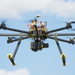
The advancement of new technology means Surveyors can now take measurements and report data with increased speed and accuracy. Modern Surveyors get to use the latest technology to get their job done every day.
Surveyors use equipment like total stations, worth upwards of $50K a pop, to electronically calculate distances 100’s of metres away, to centimetre accuracy. Robotic versions are also available, allowing Surveyors to single-handedly operate a total station by remote control.
3D laser scanners are used to understand and interpret the shape of things such as buildings or land by collecting clouds of points to create digital 3-D models. These instruments are used by surveyors to provide data to architects to accurately visualise the land they are going to build or design on.

3D image created by a Laser Scanner
Satellite positioning systems allow the measurement of features or points anywhere in the world, from space. The data collected by these systems can be used to control large infrastructure projects or provide the information for In-car navigation systems.
GIS software is used to capture and analyse data to create digital maps of areas. The high-tech software is used to create programs such as google maps, used by over 100 million people a month.
With the rapid progression of technology, one thing is certain; Surveyors will be at the forefront of latest technology. Who knows what cool gadgets Surveyors will be using next?


Comments